
Governor Newsom doubles down on methane tracking as Trump moves to weaken pollution protections
California-based partnership expands satellite monitoring to find major methane leaks, protect communities, and combat climate change
What you need to know: Governor Newsom highlighted the launch of a second methane-detecting satellite that will help California find major pollution sources and get them fixed, even as the Trump administration moves to weaken federal methane pollution protections. California’s satellite program has already helped stop 50 major methane leaks.
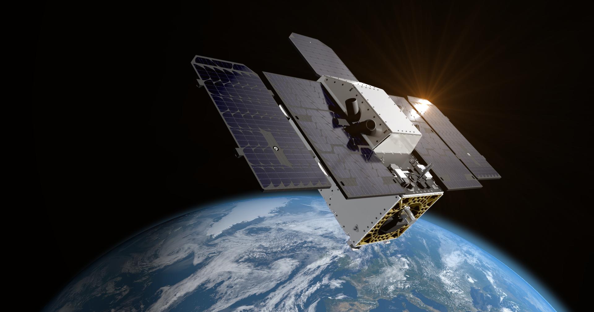
SACRAMENTO – Building on California’s success using satellite technology to find and stop major methane leaks, Governor Gavin Newsom today highlighted the recent launch of Tanager-2, a second methane-detecting satellite that will strengthen the state’s ability to track and cut pollution. The announcement comes as the Trump administration today signaled plans to eliminate federal protections requiring oil and gas companies to investigate major methane leaks detected through satellites and other monitoring technologies.
Last November, Governor Newsom announced that California’s Satellite Methane Program, known as CalSMP, had helped resolve 10 major methane leaks in its first six months using data from the Tanager-1 satellite. Today, that tally has grown to 50 large leaks, including 20 leaks at oil and gas facilities and 30 at landfills. The oil and gas leak repairs alone prevented planet-warming pollution equivalent to taking 42,000 gasoline-powered vehicles off the road for a year.
California is doubling down on methane-detecting technology to find methane leaks and push polluters to clean them up, even as Donald Trump makes it easier for them to poison America’s communities. We’re finding methane leaks and getting them fixed. This second satellite means more eyes in the sky to help stop pollution on the ground, protecting California workers, families, and children.
Governor Gavin Newsom
Advanced satellite sensors pinpoint methane leaks, and the California Air Resources Board’s (CARB) public dashboard tracks their locations and progress toward stopping them. The new Tanager-2 satellite will double the project’s coverage. That means more opportunities for targeted monitoring to spot and fix major methane releases more quickly.
Turning satellite observations into action
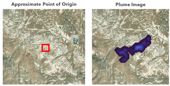
California uses satellite observations to identify large methane plumes, alert facility operators, and track their response. Adding a second satellite will strengthen the monitoring behind that work, helping the state find more emissions events and check whether operators have addressed them.
Once the data is received, addressing a leak can happen quickly. For example, in late August, California used satellite data to identify a large methane plume linked to oil and gas equipment in the Midway-Sunset oil field, southwest of Bakersfield. After CARB was notified, the source of the leak was promptly located by the operator at a flange on top of a storage tank, and repairs were completed that same day.
“The Trump Administration continues to repeal critical protections — this time on methane, a potent climate change-causing super pollutant,” said California Environmental Protection Agency Secretary Yana Garcia. “Removing federal regulations controlling methane leaks from oil and gas rewards polluters at the expense of the public’s health and will worsen climate change far beyond our borders. In California, we once again refuse to go backward. We will continue to take aggressive, science-based action to identify and address methane leaks with cutting-edge technology and policy tools designed to protect people and our planet.”
The federal rollback targets the requirement for oil and gas operators to respond to qualifying third-party reports of major methane releases. California’s program shows why connecting detection with follow-through matters: identifying pollution is only the first step; stopping it is the goal.
“Reckless federal rollbacks don’t change California law. Our methane regulations remain in place, and we’ll keep using every tool we have to cut pollution and protect communities,” said CARB Chair Lauren Sanchez. “The California Methane Satellite Project has already helped us stop 50 major leaks at oil and gas facilities and landfills statewide. This new satellite builds on that success, so we can find more leaks, fix them faster, and further reduce one of the most potent climate pollutants. We’re showing the world what strong regulation and innovative technology can do together.”
Why it matters
Methane is the second-largest source of human-caused greenhouse gas emissions with a warming impact up to 80 times greater than carbon dioxide, and reducing it is critical to protecting public health and reducing deadly pollution. Methane remains in the atmosphere for about a decade, which has two important implications: most damage occurs relatively quickly, and reducing those emissions can deliver significant climate benefits in the near term.
The new methane-detecting satellite supports California’s work to limit methane leaks and safeguard Californians’ health and well-being. That includes CARB’s Oil and Gas Methane Regulation, which requires operators of oil and gas field equipment to inspect their systems every quarter and to repair above-ground leaks, and CARB’s Landfill Methane Regulation, which requires large landfills to monitor and capture their methane emissions.
These satellites strengthen California’s pollution monitoring and oversight by enabling California to detect and notify operators of leaks in near real time.
First-in-the-nation satellite technology
The program uses satellite technology with specialized sensors mounted on the satellite to find and track large plumes from methane leaks at facilities in the state. NASA’s Jet Propulsion Laboratory in Pasadena developed the methane detection technology. CalSMP is the first major initiative to use the technology in a real-world, non-research setting. Additional satellites are expected to launch in 2027 and beyond.
Satellite technology improves CARB’s previous method of aircraft monitoring, making methane leak monitoring more cost-effective and efficient. The satellites provide a much wider view, pass over California 4-5 times a week, and can recheck leak status as needed. This repetition makes it possible to follow progress in fixing large methane leaks. It also helps determine the amount of gas involved and how long a leak lasts.
California finds methane leaks as Trump moves to weaken safeguards
California is using satellites to find major methane leaks and get them fixed. Meanwhile, the Trump administration is moving to let companies report less about the pollution they release.
The U.S. Environmental Protection Agency (EPA) destructive plans are expected to include the elimination of the federal “super-emitter” program. That program uses satellite, aircraft, and other observations from certified outside groups to identify major methane releases and requires operators to investigate notifications from EPA.
The protections matter for both public health and the climate. Oil and gas operations release methane alongside other harmful air pollutants. When EPA adopted the prior standards, it projected that the full rules would prevent 58 million tons of methane, 16 million tons of smog-forming pollution, and 590,000 tons of toxic air pollutants, including benzene, from 2024 through 2038. Weakening those safeguards will undermine those benefits. EPA also plans to revise requirements for low-producing wells— which account for a disproportionate share of the industry’s methane emissions — and reconsider how companies handle natural gas produced at oil wells, including flaring, which burns off gas instead of capturing it.
The effort comes alongside a separate push to reduce public access to pollution information. Last year, U.S. EPA proposed ending long-standing greenhouse gas reporting requirements for power plants, oil refineries, chemical factories, landfills, and many other industries — requirements that help track harmful pollution and inform efforts to protect public health. That proposal would also let most oil and gas operations stop reporting their greenhouse gas emissions until 2034.
California turns methane data into action at home and around the world
California’s Satellite Methane Project makes emissions data publicly available, giving communities a clearer picture of major methane releases and how operators respond. That commitment to transparency also provides a model for global partners seeking to turn scientific observations into pollution reductions.
Through the Subnational Methane Action Coalition (SMAC), which California launched at COP28, CARB is exploring partnering with coalition members on pilot projects in their jurisdictions. These measurements would help partners identify major leaks and take steps to address them.
By sharing its tools and experience, California is helping partners beyond its borders use science to inform the public and guide climate action.